
© Verbier
Maps of Verbier
Download the essential Verbier maps & plans
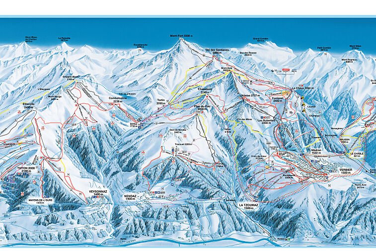
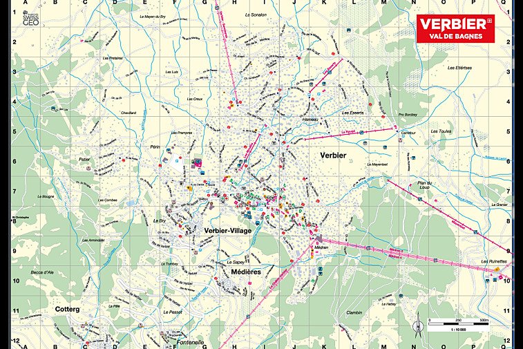
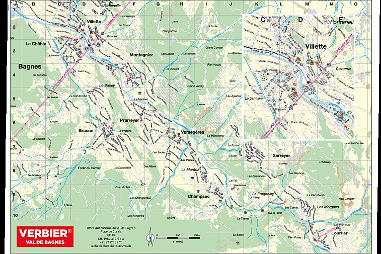
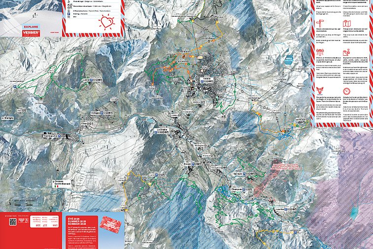
We hope this selection of piste and lift maps, street maps, and activity area maps for Verbier will help you find your way around so you can make the most of this great part of the world.
Verbier is part of the Swiss canton of Valais, situated in the Bagnes Valley and is easily accessible via Martigny. The ski resort is part of the wider 4 Vallées ski area, which also includes Nendaz, La Tzoumaz and Thyon.
Piste maps
Verbier Piste Maps |
---|
4 Vallées Interactive Piste & Ski Lift Map |
4 Vallées Live Info Piste & Ski Lift Map |
Verbier Tobogganing Piste Map |
The lifts are marked on the piste maps using straight black lines and there are four types; button tow/drag, chair, télécabine and télépherique. They have the corresponding abbreviations:
- TK - téléski (drag)
- TS - télésiege (chair)
- TC - télécabine (gondola)
- TPH - téléphérique (cable car)
Anything prefixed/suffixed with “Express” means a six-person fast chairlift.
Winter walking / trail maps
Verbier Winter Walking Maps |
---|
Verbier Winter Walking & Snowshoe Trails Map |
Cross-country skiing maps
Mountain bike trail maps
Verbier Mountain Bike Trail Maps |
---|
Verbier Interactive Bike Trails Map |
Verbier Bike Park |
Verbier XC Bike Trails Map |
Verbier Enduro MTB Map |
Verbier Downhill MTB Map |